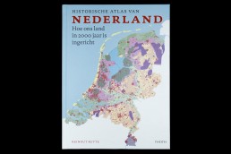
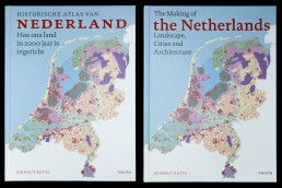
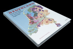
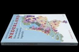
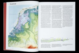
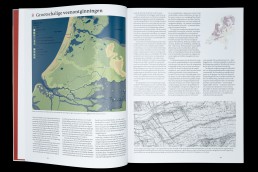
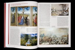
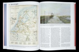
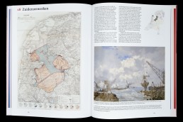
‘De Historische atlas van Nederland’ gaat over de inrichting van ons land. Aan de hand van historische kaarten, nieuw getekende kaarten, schilderijen en foto’s wordt verteld hoe Nederland in 2000 jaar zijn huidige aanzien kreeg. De rijk geïllustreerde atlas bevat een extra verhaallijn waarin de verbeelding van stad en land in de Nederlandse kunst aan bod komt. Auteur Reinout Rutte is behalve stads-, architectuur- en kunsthistoricus een fervent fietser. Tussen de regels door breekt hij een lans voor de fiets als hét vervoermiddel voor een excursie door het Nederlandse landschap.
‘The Making of the Netherlands’ explores the nation’s spatial organization and explains why the country looks the way it does. Maps, plans, paintings and photos tell the story of how the Netherlands in the course of two millennia achieved its present appearance.This lavishly illustrated atlas also presents a second narrative: the representation of town and countryside in Dutch art. Besides being an urban, architectural and art historian, author Reinout Rutte is also an enthusiastic cyclist. Throughout this atlas, his fervent endorsement of the bicycle as the ideal vehicle for exploring the Dutch landscape shines through.
TitelHistorische Atlas van Nederland. Hoe ons land in 2000 jaar is ingerichtAuteur(s)Reinout RutteFormaat33 x 24,5 cmOmvang160 pagina’sOpdrachtgeverUitgeverij ThothJaar2023Extra informatieDe ‘Historische atlas van Nederland’ maakt deel uit van de reeks ‘Historische atlassen’. Het basisontwerp van deze reeks is van de hand van Jan Boerman (†). Er verscheen tevens in een Engelstalige editie ‘The making of the Netherlands. Landscape, Cities and Architecture’. Genaaid gebonden boek met stempel.